The area to the south of Costa da Morte is the region of Fisterra, what was once called Nemancos, made up of the municipalities of Dumbría, Muxía, Cee, Corcubión and Fisterra. The southern part of this region also includes the municipalities of Mazaricos and Carnota.
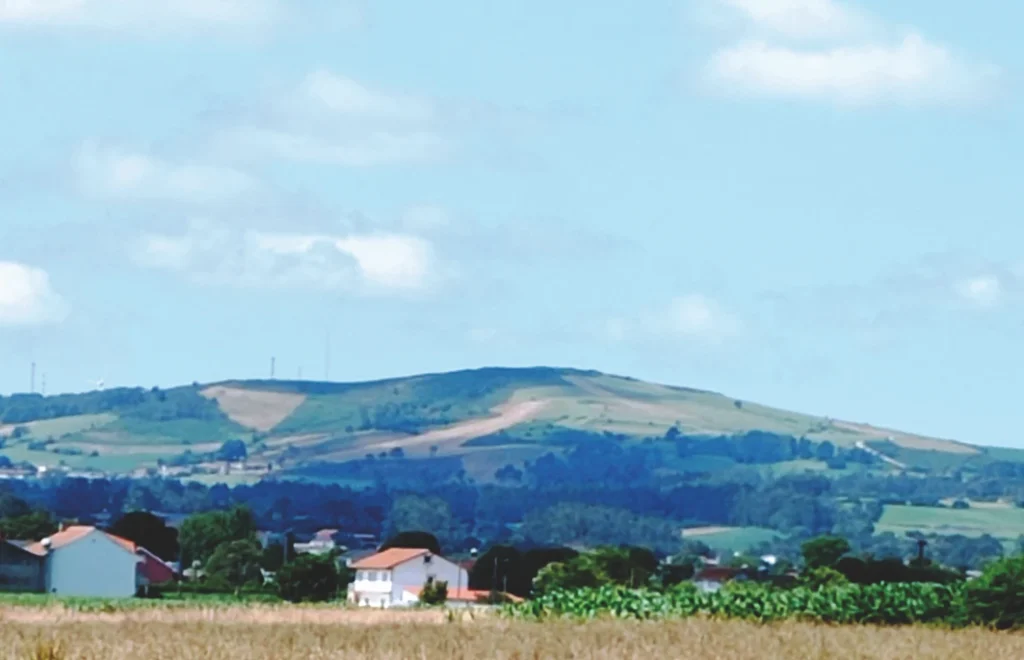
Part of this area geographically belongs to the region of Xallas, as does the eastern part of the municipality of Dumbría and the entire municipality of Mazaricos, where the last section of the river Xallas passes through.
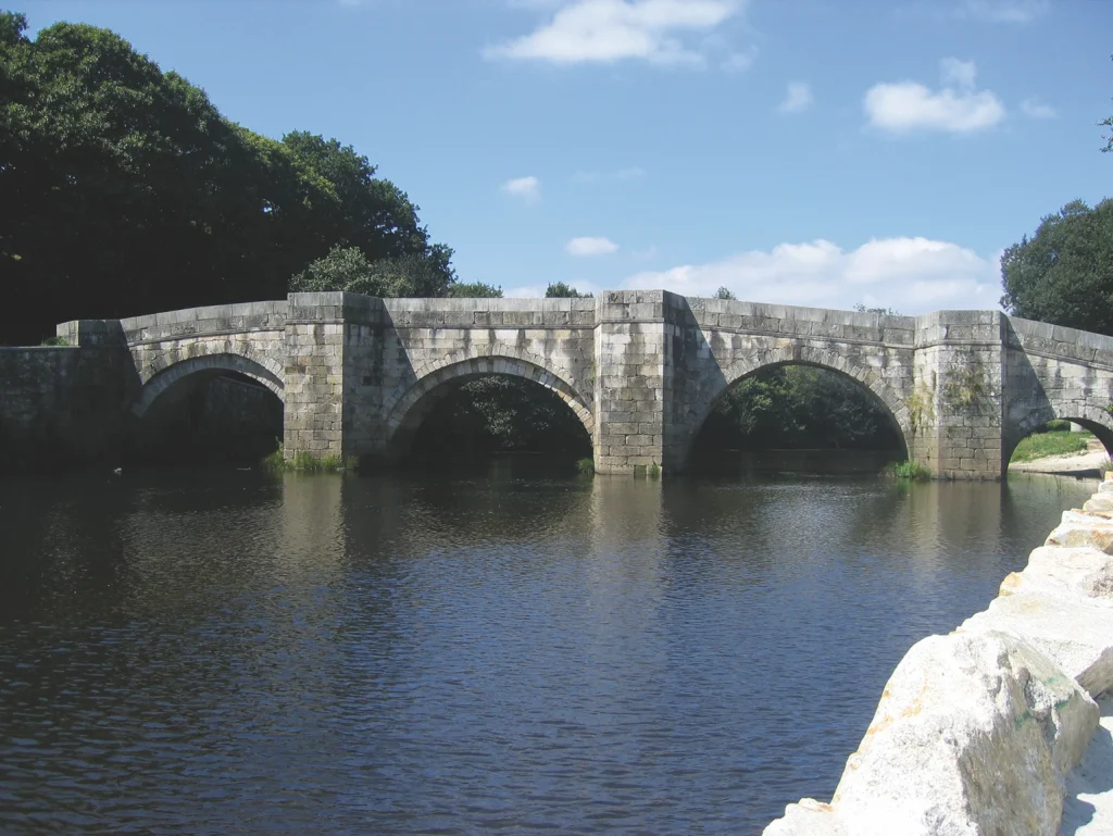
The river begins on the western bank of Monte Castelo and the river Mira, form the lagoon of Braña Rubia or Alcaián, joins it at Castriz. The river then runs calmly through the rugged plains, forming continuous meanders. It passes close to the town of Santa Comba, the capital and the commercial and service centre of the region. An old bridge crosses the river at Brandomil: it may be a replacement of another Roman bridge, as there was a sizeable Roman settlement in this area. Here you can see the still waters of the reservoir of the dam of A Fervenza, built in the 1960s
From the bridge of Ponte Olveira, where the St James Way to Fisterra and Muxía passes over, the surroundings are more rugged and the river becomes narrower. It becomes still again at the dam of Castrelo and then at the dam of Santa Uxía, before racing down a steep and very narrow slope for the last few metres between Monte Pindo and Alto da Pena. The river bed is made up of a granite that is highly resistant to erosion, while coastal subsidence led to the formation of a spectacular cascade at the river mouth, which is one of the great attractions of the area.
Another part of the region of Fisterra extends westward to the region of Xallas, along the basin of the river Castro, whose source and part of the river can be found in the highlands of the parish of Castrelo in Vimianzo, where it is called Rego Lavandeira. In Vilaseco it crosses the AC-552 road and from the parish of Berdoias it acts as a boundary between the municipalities of Dumbría and Muxía. It forms a waterfall in Castro (Coucieiro, Muxía), called Caldeiras do Castro, a very attractive natural site. It then continues through the plain area of Salgueiros, Coucieiro and Caberta, where it now acts as the dividing line between Cee and Muxía. The tectonics in the final stretch of the river force it to take a sudden turn to the west and finally flow into the small ría of Lires, though the natural course of the river would be to end at the ría of Corcubión.
The third area of Fisterra consists of the coastal zone from the parish of Leis (Muxía), inside the area of the ría of Camariñas, to the mouth of the river Xallas, in Ézaro (Dumbría).
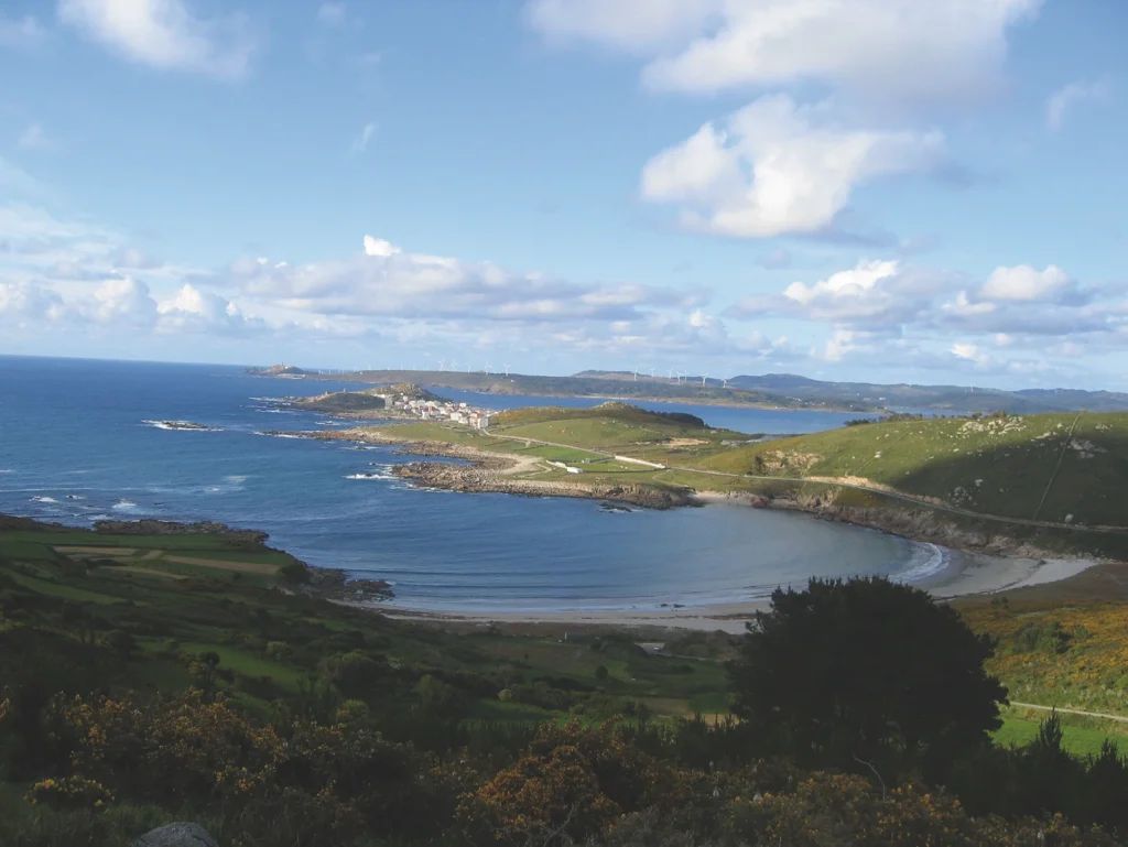
This extensive coastal region alternates between low sandy areas and other high rocky zones. The former stretch along the interior of the rías of Camariñas and Corcubión and bays where long beaches can be found, such as Praia de Lourido, Nemiña, Rostro and Mar de Fóra. The stretches of cliffs extend along the peninsulas that form the points or capes that penetrate the ocean, such as Punta do Cachelmo, where the famous cave of Burserana can be seen, Punta da Buitra, cape Touriñán, the westernmost point of peninsular Spain, cape of A Nave and the emblematic cape Fisterra, one of the most famous and widely visited locations of the Spanish coast.