This long route goes from Malpica to cape Fisterra, and follows the coastline between the two points. It came about from the initiative of a small group of people who decided to go on a walking adventure at the end of 2012. They faced a lot of difficulties because most of the route didn’t have any kind of track or path to walk on. After doing some stages at the weekends, they finally reached cape Fisterra on 26 January 2013.
Before this daring initiative, a couple of proposals had previously been made with the same idea of a coastal route on foot through the same region, although a slightly less hazardous and ambitious one, where sections of the route through the steeper coastal areas were avoided. The first was called the Itinerary on foot through Costa da Morte, and can be found in a book entitled Deporte e aventura na Costa da Morte (Edicións Lea, 1998). This route matched the first Camiño dos Faros in that the start and end and the whole route was divided into eight stages.
The second route was proposed in 2011, with the title Route on foot through Costa da Morte. The same title was used for a book published in the same year by Asociación Nería. This time the route went from Malpica to Muros and was divided into 10 stages. Besides the descriptions of the route and maps for each stage, the book also contains information about the most interesting natural spaces and historical sites to be found along the way.
The project by Asociación Nería was inaugurated with a ceremony at the town of Malpica and the completion of a stage in May 2012 between O Roncudo and the dolmen of Dombate. Sadly, the crisis that the association was going through at the time stopped the project from going forward. The book was distributed at promotional events for tourism and establishments in the sector, and amongst persons who were interested in the route.
However, the route proposed by the promoters of the Camiño dos Faros, which is closer to the sea, more difficult and with a higher level of risk, offered more excitement to people interested in the route, making it different from the previous ones, as Javier Mazorra, a journalist of the newspaper El Mundo (28/07/2015), commented in a report he wrote about the Camiño dos Faros:
“Several stages match the old Ruta a pé pola Costa da Morte but there is a difference: you walk almost all the 200 kilometres of the route on the same coast, almost always on paths or trails, without ever losing sight of the sea”.
The Camiño dos Faros between and Malpica and cape Fisterra is about 200 km, runs alongside the coast and is marked with green arrows and points. It is divided into eight sections of different lengths depending on the difficulty of each one and the conditions in each area.
The shortest and easiest one is Laxe-Arou, at 18 km, while the longest is Camariñas-Muxía at 32.6 km. The difficulty of the stages increases as you progress along the route; the last two are probably the most difficult ones of all.
The average duration of each stage is about 8 to 9 hours, at a speed of 3 km/h, to give you a chance to enjoy the scenery as you go.
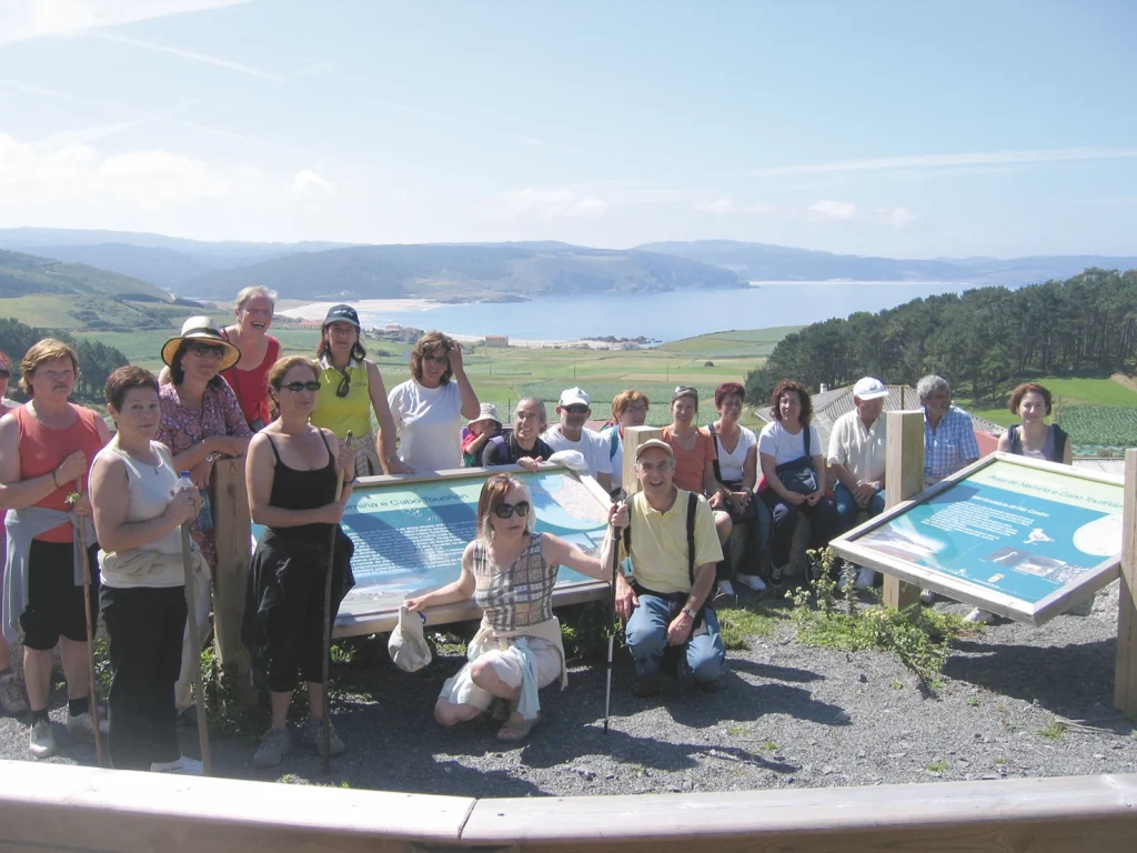
The Camiño dos Faros association was created in 2013 to consolidate and maintain the route. Two walks along the route were organised the same year, one in the summer and the other in winter. Another two were organised in 2014 for spring and autumn, and one more walk was organised in spring 2015. A lot of people participated in all the events. The association actively campaigned on the social networks and media to promote the route and contacted government bodies to have it certified, which was impossible due to the number of bureaucratic obstacles it encountered along the way. Most of us are unaware of the difficulties that impeded this route from being certified as a long-distance trail, especially in view of all the success it has had, since it represents a tourist resource of great value and interest for Costa da Morte, besides being one that would help to develop the region. It would be a shame to lose this resource when all the municipalities that the route passes through agree that the project should be fully established.
> Stages of the Camiño dos Faros
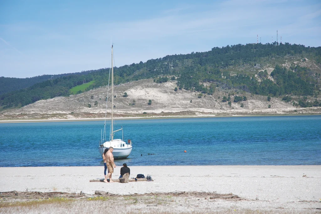
Stage 1: Malpica-Niñóns, 21.3 km
This stage starts at the town of Malpica and continues to the chapel of Santo Adrián. It passes by the beaches of Area Maior, Canido and Seaia and the rises upwards to the spring and hermitage of Santo Adrián, where a very popular pilgrimage is held every June. There are some fantastic views of Malpica and the Sisargas Islands from here. Sisarga Grande has a lighthouse (1853), one of the first to be built on this coast.
After skirting the headland of Santo Adrián, head off to the beaches of Beo and A Seiruga. The second of the beaches has a river that you have to cross. It’s easy to cross in summer but harder in winter because of the high water levels.
The route gets tougher after the port of Barizo because it rises up to the peninsula of A Nariga. The lighthouse of Punta Nariga is at the end of this peninsula. The building is a recent one and was designed by the architect César Portela. The route continues to skirt this area of the coast, which has a lot of cliffs and then after passing by the bay of O Lago you come to the beach of Niñóns and the end of this stage.
Stage 2: Niñóns- Ponteceso, 27.1 km
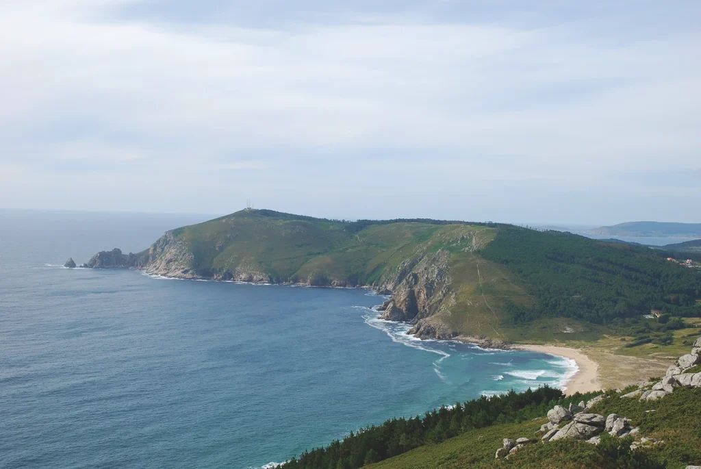
This stage circles the peninsula of O Roncudo and consists of two sections with very different landscapes. The first one is a rugged rocky coastline that accompanies you to the headland of O Roncudo, while the second is a gentler coast with protected beaches that ends at the estuary of the river Anllóns.
Start the route at the beach of Niñóns and from there take a coastal track that goes to the small port of Santa Mariña. Then there is a stretch of cliff-lined coast that takes you to the bay and beach of A Barda, where you head off once again on the track that skirts the northern part of this rugged peninsula. Pass through the O Roncudo, which is a small hamlet lodged in the midst of this harsh landscape. The track continues to skirt the peninsula up to the headland of O Roncudo, the most emblematic place on the entire coastline, where the lighthouse is located. Then head off to Corme, which is the most important town in the northern part of the ría and birthplace of the famous explorer Francisco Mourelle de la Rúa (1750-1820).
The route continues along the beaches of O Osmo and A Ermida and borders the northern part of the ría. It passes near the sheltered beach of Balarés, which is surrounded by a large green space. From here take the narrow trail that skirts the coast, until you arrive at the beach and dunes of A Barra. If you want to see some magnificent views of the area, head up to the top of Monte Branco and go down again to the banks of the estuary of the Anllóns. Then follow the trail that takes you to Ponteceso and the end of this stage.
Stage 3: Ponteceso-Laxe, 25.3 km
This third stage starts at the house of the poet Eduardo Pondal (1835-1917), and after crossing the bridge over the river Anllóns, it enters the municipality of Cabana de Bergantiños and continues along the left bank of the river estuary and the southern shore of the ría of Corme and Laxe. There is a diversion inland to see two very interesting archaeological sites: the castro of A Cidá de Borneiro and the dolmen of Dombate.
The first part of the route runs along the left bank of the bay of A Insua, firstly through a hilly area and then along the path that skirts the beaches of A Orexeira and O Pendón before arriving at the bay of O Lodeiro. It then follows the trail of the stream of Os Muíños and then rise up to the hillfort of A Cidá de Borneiro, an ancient Iron Age settlement. From there it goes to the dolmen of Dombate, which is the most famous megalithic monument in Galicia. The route then rises to the top of Monte Castelo, an ideal vantage point to see the beautiful coastal landscape.
If you decide not to visit A Cidá and the dolmen of Dombate, the route is shortened by almost 10 km and is much easier to traverse. Go up from the bay of O Lodeiro to the church of Canduas and then carry on along the same track.
The route then descends to Canduas and takes you back to the coast, crossing the beaches of Rebordelo and San Pedro along the way. It continues along the cliffs that surround the headland of O Cabalo and then heads south close to the bay of the mills at Frexufre. It then crosses O Cabo da Area at the east end of the large beach, which you cross and then come to the town of Laxe and the end of this stage.
Stage 4: Laxe-Arou, 18 km
This is the shortest and easiest stage of the entire route. It starts at the port of Laxe, very close to the Gothic parish church of Santa María da Atalaia, well worth a visit. Then follow the PR-G 70, a short route that borders the A Insua peninsula and takes you to the lighthouse, the Furna da Espuma and the beach of Os Cristais.
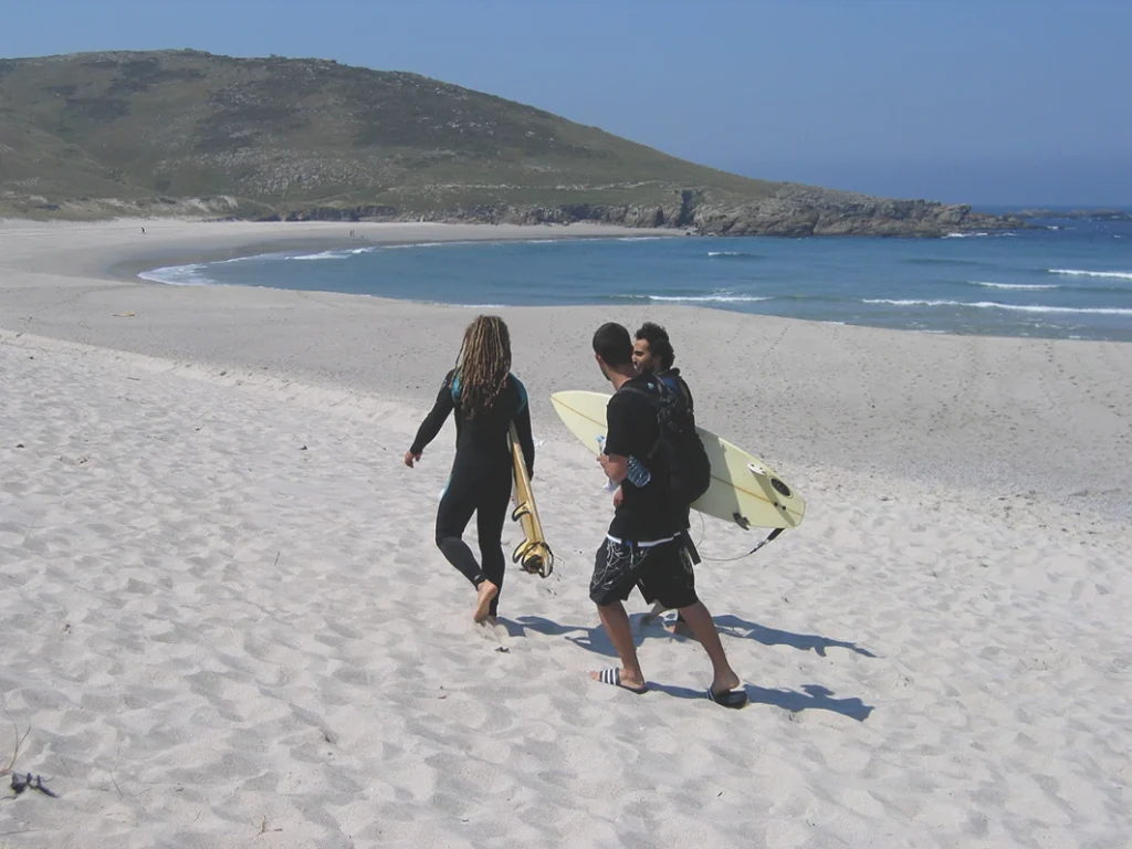
Continue on the trail that skirts this cliff-lined part of the coast, passing near the bay of Baleeira and the headland of O Peñón till you come to the beach of Soesto, a long stretch of sand with waves that are ideal for surfers. Then go up to the high point of Monte Castrallón and walk round Punta Catasol. Continue alongside the beach of O Arnado to the next one at de Traba, another long beach with a coastal lagoon and a good spot for birdwatching.
After the beach, the route then enters an area of granite rocks in all kinds of shapes and sizes that are worth stopping to see. Then keep on going to the bay of Sabadelle and pass by the pebbled beaches of A Señora and Sabadelle. Shortly after you come to the entrance to the bay and the coastal town of Camelle. This small fishing port is well-known because of Man, a German who lived here for forty years and made a deep impact on the town. There is a museum with some of his art on display.
Your next destination is the small town of Arou, which you arrive at by taking the track that skirts the coast and takes to a beautiful beach and the end of this stage.
Stage 5: Arou-Camariñas, 23.8 km
This stage is perhaps the most representative one on the Camiño dos Faros because it passes along a stretch of rocky, jagged coastline that is extremely hazardous for shipping. The many ships that have run aground and sank here are the reason why this region is called Costa da Morte (the Death Coast).
The route starts on the track that goes to the solitary beach of As Lobeiras and continues along a coastal path with dangerous cliffs, surrounded by headlands and small bays, that goes to the small port of Santa Mariña.
From here the trail goes up to O Penal do Veo and descends along the west slope where the impressive dune of Monte Branco was formed. The top offers fantastic views of the beach of O Trece and Cabo Tosto. Once you cross this long, wild beach, you come to the English Cemetery, which is one of the most important symbols of the coast. It is the final resting place of the bodies washed ashore from the wreck of the British vessel Serpent, which ran aground here on 10 November 1890 at Punta do Boi. The route then continues along the dirt track that runs parallel to the coast, with some magnificent views of cape Vilán and its lighthouse along the way. It passes near the beaches of Reira, the high point of A Pedrosa and the bay of A Arliña and joins the road to the Vilán lighthouse, another important symbol of Costa da Morte. It was the first lighthouse in Spain to be powered by electricity. It is regarded as one of the best buildings on the Iberian Peninsula for its location and for the construction of the tower.
After seeing the lighthouse, you now head along the coastal trails that takes you to the chapel of A Virxe do Monte, after passing the headlands of O Corno and O Castelete. The chapel looks out over the Atlantic from the top of Monte Farelo, an ideal place to view the coast of Muxía.
Head back to the coastal path that continues along the beach of O Lago and the headland of Villueira and reaches the ruins of O Soberano, which was a castle built in the mid-18th c. The houses of the town of Camariñas come up to this point. Continue down the street that goes down to the port, where this fifth stage comes to an end.
Stage 6: Camariñas- Muxía, 32 km
This stage is the longest one of the routes. It skirts the ría of Camariñas and links the two fishing towns of Camariñas and Muxía at each end. It is something of a contrast to the previous stage with its wild seas and cliff-lined coast, here the setting changes to a gentle and sheltered coastline, full of vegetation and long sandy beaches.
Set out from Camariñas and at the end of the town you’ll find the beach of Area da Vila. Further on there at the bay of A Basa there is an area for shellfish catching where cockles and clams are especially abundant. The track borders the bay and Monte A Insua and passes near the beaches of Area Branca and O Ariño, at which point you are now in the estuary of the river O Porto.
The route follows the road from A Piosa and crosses Dor and O Allo to the town of Ponte do Porto, the old commercial centre for the surrounding villages where a very popular fair is held. Cross the river O Porto on the bridge that gave the village its name and continue on the riverside path that takes you to Cereixo in the parish of Vimianzo. A welcoming place with some interesting sights, such as the tide mill, the Romanesque church of Santiago and the towers that once belonged to the counts of Maceda.
After a distance next to the road, the route then changes and enters a forested area that goes to the shore of the ría. After passing near the Furna do Sapo and the beach of Area Grande, you come to the beach of A Barreira or Leis, separated from the beach of O Lago by a rocky outcrop where a small lighthouse is situated. O Lago is one the most beautiful and popular beaches on the ría. Leave the beach, cross the bridge and walk for a distance beside the road, then take a track that goes to Merexo, a hamlet with a lot of traditionally built houses and hórreos.
Then continue along this section of the Way of St James to Os Muíños, then go down the riverside track that follows the river Negro, surrounded by a leafy indigenous forest and several mills that takes to the Area Maior, another excellent beach on the shores of the ria.
Then walk up to the hamlet of Chorente. You have two options to get there: follow a trail that starts at the end of the beach, crosses the hill and ends at the hamlet; or take the tarmac road and then turn right onto the Way of St James that goes to Moraime, which was once a monastery and is now a centre of some historical and architectural importance, including a splendid Romanesque church. Then head off towards Chorente. Then walk down to the beach of O Espiñeirido and take the wooden walkway to Muxía. Walk through the town and continue in the direction of the sanctuary of the Virxe da Barca and the end of this stage.
Stage 7: Muxía-Nemiña, 25.3 km
This stage is perhaps the hardest of the entire route, especially the section that goes from the beach of Lourido to the one in Moreira (9.3 km), which has some steep peaks and troughs.
The route starts at the Praza do Coído in Muxía, where you take the road to Lourido until it descends to the beach with the same name. Cross the sands and opposite you’ll see the parador Costa da Morte, located on one side of the hill. The track skirts the coast up to the pebbled beach of the river Escuro, where the steep climb up Monte Cachelmo begins and where some magnificent views await you when you reach the top. Then head down to the small beach of A Arnela and go up another steep slope to the east of the peninsula of A Buítra up to the trail that goes to one end of it, which is the one you’ll take. Now the trail skirts the headland along the west and offers some good views of cape Touriñán. Head down to the cove of Cuño and after you cross a small stream there, it’s time to make the ascent of Monte Pedrouzo (272 m). Walk along the top and then head down towards the beach of Moreira.
The route gets gentler from here, as you walk along a track that takes you to cape Touriñán, which we first skirted on the right had side when going to the lighthouse. This is the westernmost point of peninsular Spain. Now the route skirts the peninsula on the west side until the cove of Touriñán.
Walk through the hamlet of Campos, where you turn right onto the track that goes to Nemiña and the diversion to Talón. Go down from here to Nemiña, a large sandy beach that’s popular with surfers, and the end of this penultimate stage.
Stage 8: Nemiña-Cabo Fisterra, 26.9/22.2 km
This last stage of O Camiño dos Faros is also tough because of the steep slopes in some section, especially near cape A Nave and Monte Facho.
You can start this stage at Nemiña beach, where the previous stage ended, or at Lires. If you start at Nemiña, there’s the problem of crossing the river Castro, which is only possible at low tide and and in summer. If not, you have to take a detour of over three kilometres and cross it at the bridge of Vaosilveiro. If you start at Lires, you’ll save yourself the detour and walk 22.2 km instead of 26.9 km.
Walk from Lires to the beach with the same name and then continue along the coastal path. You’ll pass near the beaches of Area Pequena and Area Grande and close to the cliffs of Punta de A Lagoa and Punta Besugueira before coming to the O Rostro, a long wild beach with big waves.
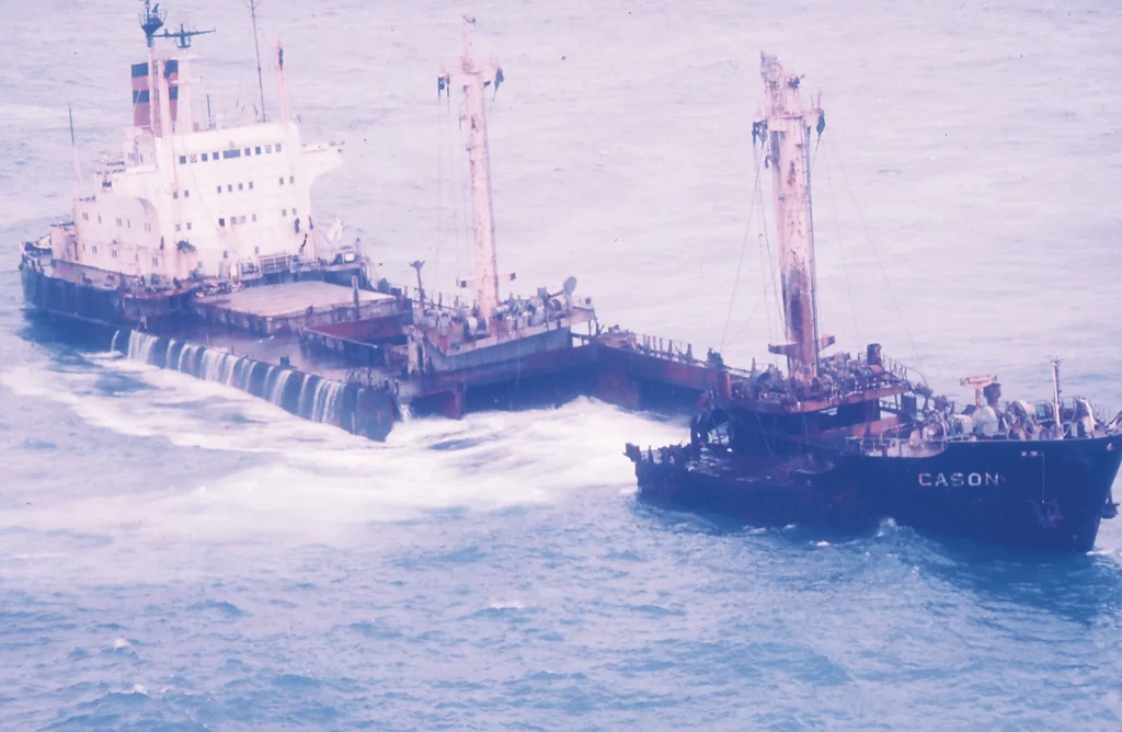
From here on it is uphill all the way along a cliff-lined area up to the top of Monte Castelo. The hillfort of Castromiñán is on one of the headlands here. A ship called the Cason ran aground near here in 1987 and provoked panic amongst the residents of the region.
After passing through the solitary beach of A Arnela, you start the hardest part of all, the ascent of Monte Veladoiro, which forms the cape of A Nave. A steep slope takes you down to the beach of O Mar de Fóra, the last one on this coastal route. Carry on along the track that takes you to the small hamlet of A Insua, and once there, take the track that skirts Monte Facho to the west and goes up to the summit. This final effort is well rewarded with some spectacular views from this fantastic vantage point. Now the only thing left is a comfortable walk down to the Fisterra lighthouse, the final point on this extraordinary adventure. After a long walk of eight days, the cape and lighthouse of Fisterra, both perched on the edge of the European continent, are a perfect end to this Camiño dos Faros.