Take the AC 552 from Carballo towards A Coruña and about 3 km further on in A Rega, turn left onto the CP-1909 road to Caión. When you reach the high point of San Miguel de Vilela, look left and you’ll see some wonderful views of the natural space of Razo and Baldaio. When you come to the km 8, turn left onto the CP-1913 to Pedra do Sal and our next destination.
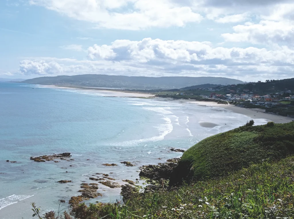
>Natural space of Razo-Baldaio
The origin of this ecological site lies in the fault of Baldaio which runs in a NW-SE direction through Lendo and A Laracha and reaches Meirama. The fractures caused by the tectonic movements associated with the fault established the elevation of some blocks and caused others to sink. The former correspond to the high areas of the ridges that define the entire depression, while the latter opened the way to the coast, where the sea would enter later.
The material brought by the streams that flowed into the bay gradually filled the bottom of the depression with sediment; then the action of the marine currents created a sand bar that closed off the outlet for the river water and created the lagoon. It gradually evolved and slowly became a mixture of grassland and wetland, while the hydrological area shrank. This natural space therefore contains different type of habitats: beach, dunes, reed beds, wetlands and lagoon.
The beach is is over five kilometres long and is made up of a large sandbank formed by the prolongation of the sand bar from Razo to A Pedra do Sal. The shapes of the beach changes constantly due to tidal action and the state of the sea. You can see micro-cliffs, ripplemarks and beds of stones produced by wind action.
The dunes are the sand barrier that separates the wetlands from the marine lagoon. They vary from five to seven metres high, and spread out over three kilometres from east to west. Three types of dune can be distinguished: primary, which are closest to the beach and mobile because they are less colonised by vegetation; secondary, which are more fixed and further from the sea; and tertiary, which are totally immobile and fixed by vegetation. This cordon of dunes is cut by cross-sectional corridors that are penetrated by the sea during especially fierce storms.
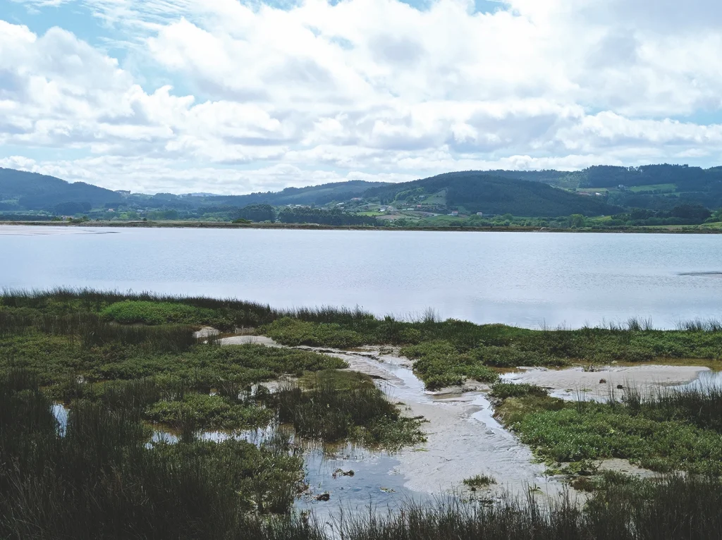
The reedbed is to the west of the lagoon and occupies about 100 hectares. It is triangular in shape and demarcated by the dunes, the lagoon and nearby farmland. It was originally part of the lagoon, but was gradually filled until it became a plain covered with vegetation. The lower areas are flooded by fresh water in autumn and winter.
The wetland extends mainly to the south of the lagoon. It is made up of masses of silt and sandbanks with ruts that tidal waters run through and where local streams flow into the sea. There are areas that are temporarily flooded. Plants that can withstand high levels of salinity such as glasswort and common sea lavender grow in the area closest to the lagoon.
The lagoon occupies the easternmost part of the depression. It is elliptical and the main axis runs from east to west. The mass of water in the lagoon depends on the state of the tides and the rivers that flow into it. It has been affected by human intervention, especially by the trail built in 1975 that divided it into two sections: the larger of the two is in the north while the smaller one lies to the south. Subaquatic plants such as the sea lettuce can be found in the lagoon.
The entire area is rich in chemical nutrients, which makes for an abundance of microbes. This in turn has encouraged a large number of fauna to live here according to the type of ecosystem they prefer. The lagoon is inhabited by molluscs (cockles, clams and longueirón); crustaceans (crabs and prawns) and fish (bass and mullet). Birds inhabit the entire area. It is a stopping off point for migratory birds in autumn and winter. Waders and waterfowl are the most common types of bird here.
The wetland has long been used by the local population for catching shellfish, until a concession was granted during Franco’s dictatorship to a company to install a fish and shellfish farm, although it later turned out be a cover for extracting and selling sand. This sparked off a major conflict with local residents, who were prohibited from gathering shellfish. After a long struggle of over forty years, the residents regained their rights.
Human intervention drastically affected this natural space, and it is now vital to take whatever protective measures are necessary to prevent further degradation of the area.
Leave A Pedra do Sal and turn left on the road that passes through Imende and finally takes you to Caión.
At the km 12 point on this road, the left hand side has a wonderful viewing point over the town and the peninsula. It’s well worth stopping a while to take a look.