Terra de Soneira occupies the central part of Costa da Morte. It is a region that extends from east to west from the peak of Meda to Cabo Vilán and is made up of the municipalities of Zas, Vimianzo and Camariñas, the first two of which are located inland while Camariñas is on the coast.
The region is also flatter and lower than the plateau of Xallas. It can be divided into three areas: the valley of the river Porto, the land further south from which water flows to the Xallas and Castroi rivers, and the coastal area.
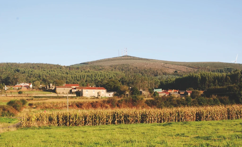
The valley of the river Porto occupies the largest part of the region and its highest point is Pico de Meda (567 m), with its conical profile shaped like the haystacks or medas typical of the region, from which it gets its name. It is a truly exceptional vantage point over the lands that surround it; sometimes even the sea is visible.
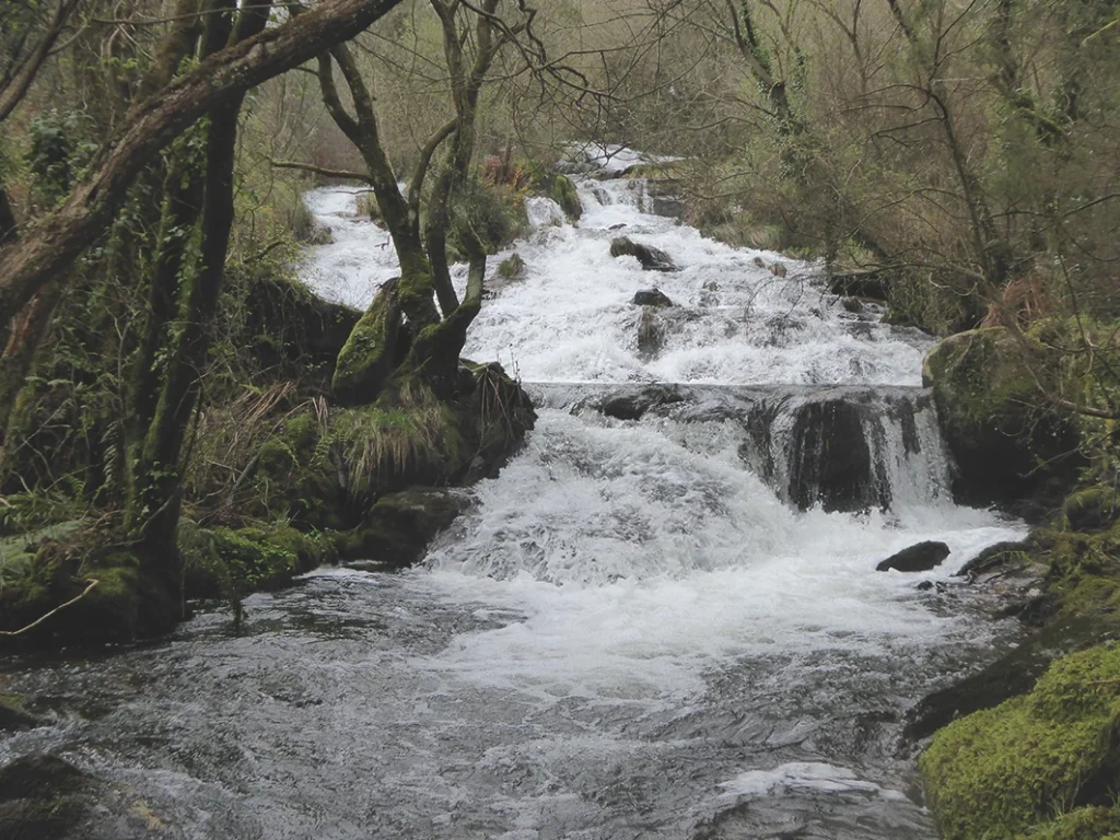
The source of the river Porto, the main artery of the region, running from east to west, is located on the eastern side of this mountain. On its way through this high part of the region, it passes between the plateaus of Xallas and Soneira in a steep gradient to form the waterfalls of O Rabiñoso, creating an attractive natural and ethnographic setting in which the cascading waters were used to power the wheels of several mills.
The river winds it way lazily down the rugged slopes of this valley. The network that forms the tributaries of the river is highly asymmetrical, as almost all of them join it from the left-hand side from the south to the north, since their sources are in the highlands that border the region of Xallas. The Zas and Vilar rivers are the largest of these tributaries.
There are two areas of interest in this middle section of the river: the attractive landscape of the area of Pedra Vixía, on the Zas river, with its well conserved riverside woodland and a leisure area next to the river, and A Carballeira da Devesa, next to the town of Baio, one of the most valuable native woodlands to be found along the course of the river.
Just a short distance from Baio, and further downstream, is the ethnographic site of the mills and fulleries of Mosquetín, with seven watermills and three fuller’s mills. There are records of the site dating back to the 18th century and the complex itself is unique in Galicia.
The Porto river slowly winds its way through the parishes of Salto and Calo, apart from the area in Foxo, where the banks narrow and the waters flow more rapidly. The river’s potential is used here for hydroelectric power.
It is joined in the second parish by the Cambeda river on the left-hand side, which crosses the valley of Vimianzo, a tectonic trench between the mountains of San Bartolomeu and Faro, the two high blocks of the fault. The town of Vimianzo, founded at the foot of a Medieval castle, is the largest urban centre in the valley.
The final stretch of the Porto river becomes more uneven due to the morphological changes of the area that force a narrower course in which the waters now accelerate towards the town of Ponte do Porto.
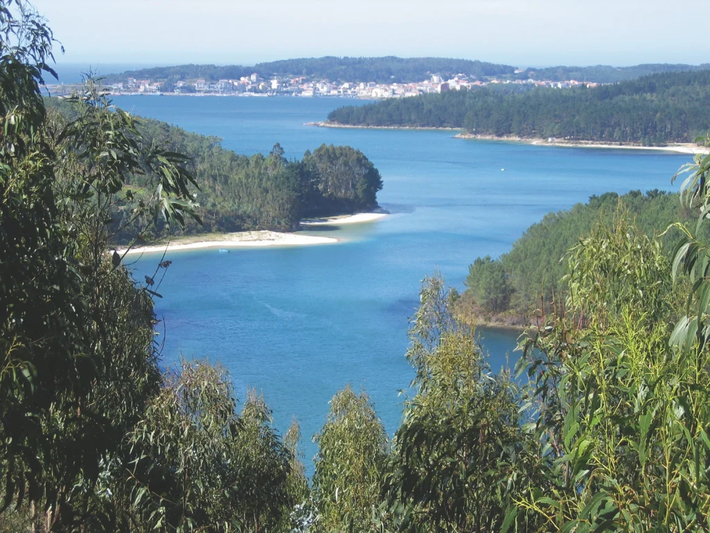
Further downstream from the bridge of Ponte do Porto, the river broadens its course and forms an estuary that extends a further 5 km to where it meets the sea at the ría of Camariñas, after a journey of over 47 km. In this section, the water of the Carnés river joins the Porto in Cereixo and passes alongside the Romanesque church of Santiago de Cereixo under the only tide mill to still be conserved in Costa da Morte.
The second area of Terra de Soneira is made up of the southern part occupied by the municipalities of Zas and Vimianzo, whose waters run into the river Xallas, as is the case with the parishes of Muíño, Brandomil and Brandoñas in Zas and Baíñas in Vimianzo. The territory occupied by these parishes forms part of the region of Xallas, with which they share physical and geological similarities.
The area in the basin of the river Castro, like the parishes of Castrelo and Berdoias in Vimianzo, are separated from the others by a chain of mountains whose highest point is Alto da Cruz (536 m), a magnificent viewing point to see a sizeable part of Soneira, Xallas and Nemancos.
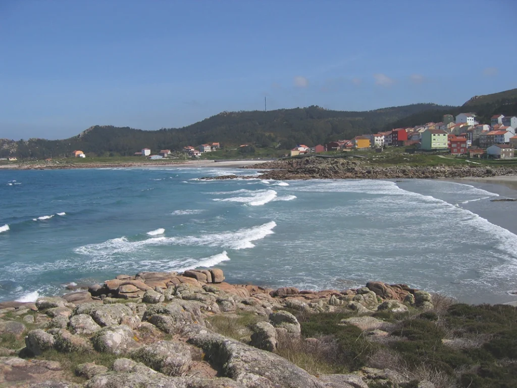
The third section is the coastline of the region, including practically all the municipality of Camariñas. It commences in Sabadelle, the only outlet to the sea in the municipality of Vimianzo. It then opens up at the small cove of Camelle, with a beach to the rear, where this fishing village can be found. A short and rocky section then leads to the beach of Arou, where the sea can be rough, although the beach itself is a good bathing spot.
From here on a very rocky and rough section of the coast commences, where an abundance of reefs makes this area very dangerous for navigation. Outcrops alternate with small coves like the teeth of a saw up to Punta do Capelo, the easternmost limit of the small cove of Santa Mariña. The cove of Trece is located between between Cabo Veo and Punta do Boi. The bay itself is a large sandbank with a highly developed system of dunes, which gave rise to the spectacular Monte Branco
At Punta do Boi visitors can see the English Cemetery, where bodies from the wreck of the English ship Serpent are buried. This section is the most rugged and hazardous of the entire coastline and is where the greatest marine disasters took place.
From Punta do Boi onwards, the coast continues to be abrupt and rugged until the entrance to the ría of Camariñas. This section is notable for the promontory of Cape Vilán, with its spectacular lighthouse, which dates back to 1896 and was the first in Spain to use electricity.
The entrance to the ría of Camariñas opens up between A Virxe da Barca and A Virxe do Monte, in much the same way as the similarly shaped ría of Corme and Laxe. There are also fishing villages on each side of the ría. Camariñas is on the northern side while Muxía lies to the south along with two coves, A Basa and Area Maior. The ría continues eastwards via the estuary of the river Porto to the town of Ponte do Porto.