This region is the largest of the three that form Costa da Morte and is made up of the municipalities of Laracha, Carballo, Coristanco, Malpica de Bergantiños, Cabana de Bergantiños and Laxe.
The morphology of the area is similar to three large steps. The first step are the highlands belonging to the municipalities of Laracha, Carballo and Coristanco, which the local people themselves call A Alta (the highland), situated between 300 and 400 m in altitude. Some of the highest points reach more than 500 m, such as Coto de Predouzo (518 m), A Pedra Cerdeira (564 m) and Monte Castelo (564 m).
The second step is the basin of the river Anllóns, an artery that crosses the region from east to west and springs from the meridional slope of the Coto de Pedrouzo. After circling round the mountain, it descends sharply to the plateau of Bergantiños, where it flows more gently. After passing through the town of Carballo, it receives its main tributary, the river Rosende, on the left-hand bank, fed by waters from the highlands on the borders of the Ordes plateau.
When it reaches Verdes, the river takes on new life due to tectonic movements that affected the area, forming rapids and cascades that enable it to adapt to its new level. The river then comes into contact with harder rocks, such as the gneiss that spring up from the riverbed, more resistant to erosion, and its course is divided into several streams, which creates the beautiful natural space of Refuxio de Verdes.
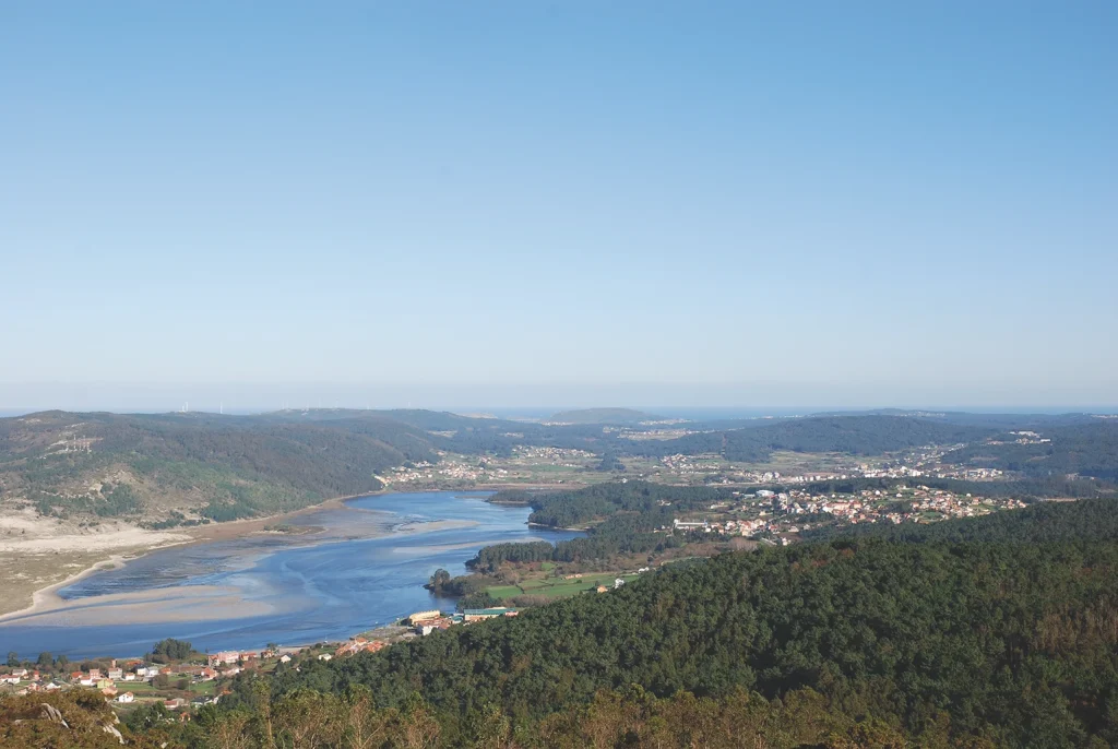
After passing through the parish of Corcoesto, the river flows calmly once again until its mouth at the town of Ponteceso. Before it reaches the town, it forms a large meander in the parish of Anllóns, which gave the river its name. After passing under the bridge of Ponteceso, next to the house of the poet Eduardo Pondal, it enters the cove of A Insua, a wide estuary and a space of great natural interest that continues up to A Barra, where its waters mingle with the Atlantic Ocean in the ría (the local name of estuaries) of Corme and Laxe after a journey of over 70 km.
Pondal refers to this final stretch of the river’s passage through the region in one of his poems:
I was born in wild solitude, I was born from the wild hills, where the Anllóns, with noble majesty, wanders towards its ultimate fate.
The centre of the region of Bergantiños is occupied by the lowlands of the valley of the Anllóns and its two tributaries. Here the soil is a reddish colour, “red lands turned by the plough”, as Pondal says, formed on basic rocks, giving rise to fertile terrain and the name of the “granary of Galicia” because of the abundant production of cereals in ancient times. The area now produces excellent potatoes, beans, vegetables and fodder crops.
The third and final step consists of the land that descends down to the sea, forming an extensive coastline mostly of granite rocks, in which high stony areas alternate with sandier zones that are open to the sea.
Between the coast and the valley of the Anllóns there is a small range of mountains that reaches the coast and rises up to form a string of high cliffs, where waves crash against the rocks. The highest of these hills is Monte Neme (386 m), which looks like a watchtower over this part of the coast and the territory further inland. This strategic location, combined with the wealth of its mines and its history, have made it a place of myth, tales and legends.
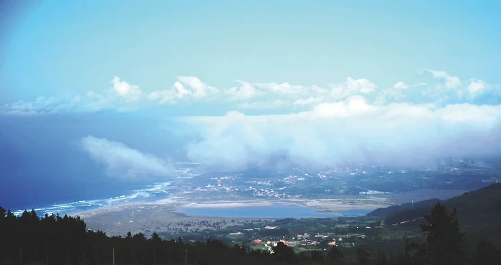
The coast of Bergantiños starts at the peninsula of Caión, where the small fishing port of the same name stands next to the beautiful beach of Salseiras. The coast then continues, where rocky cliffs dominate until the large sandbanks of Razo and Baldaio, where a coastal lagoon was formed. The entire area is a natural space of great interest.
The section that extends from Razo to the peninsula of Malpica consists almost entirely of cliffs, with a few headlands and some islets. There are a few beaches to be found here, such as those at Torradas and Riás.
The small peninsula of Malpica, on which the fishing town of the same name stands, culminates at the peak of A Atalaia, with the fishing port to the east and the beach Maior to the west. The reduced space available to the townspeople has obliged them to build their houses one on top of the other around the small bay of the port; some of them appear to be hanging from the very cliffs, which gives this fishing town a lot of charm and personality.
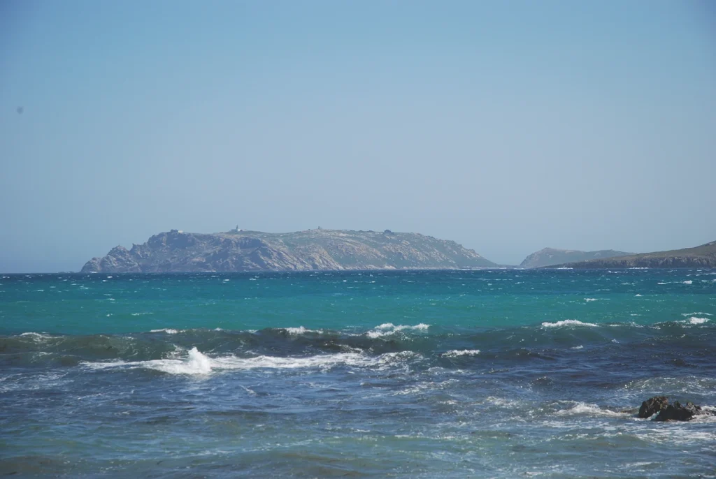
The coast continues along the cape of Santo Adrian, a rocky peninsula with a chapel dedicated to the saint where a very popular pilgrimage is held every June. Opposite this headland you can see the Sisargas Islands, the only sizeable archipelago to be found in Costa da Morte.
From here on the coast becomes more abrupt, with areas of steep cliffs that border the peninsulas of A Nariga and O Roncudo, where some narrow coves with sandy beds can be found, such as A Seiruga, Barizo, Niñóns and A Barda.
The outlet of the ría of Corme and Laxe opens up between O Roncudo, to the north, and A Insua, to the south. This area is more protected from the wind and the sea than the open coast, and the two largest towns in the area can be found here. The port of Corme lies to the north while Laxe is in the south. Further inland in less rugged country are the villages in the parishes of Cospindo, Cesullas and Canduas, the largest of which is Ponteceso, at the mouth of the river Anllóns.
After the peninsula of A Insua, the last section of the coast of Bergantiños consists of two large areas open to the sea, with rough waters and constant waves: the first is the beach of Soesto, between Punta Carreiroa and Catasol, well known as an ideal locations for surfing and the beach of Traba, a wild sandbank bordered by dunes that contribute to the formation of a small coastal lagoon at the bottom of the low valley that surrounds it.