Starting-arrival point: Car park of the castro A Cidá de Borneiro
Route: circular
Distance: 10 km
Approximate duration 4 h
Difficulty: Medium
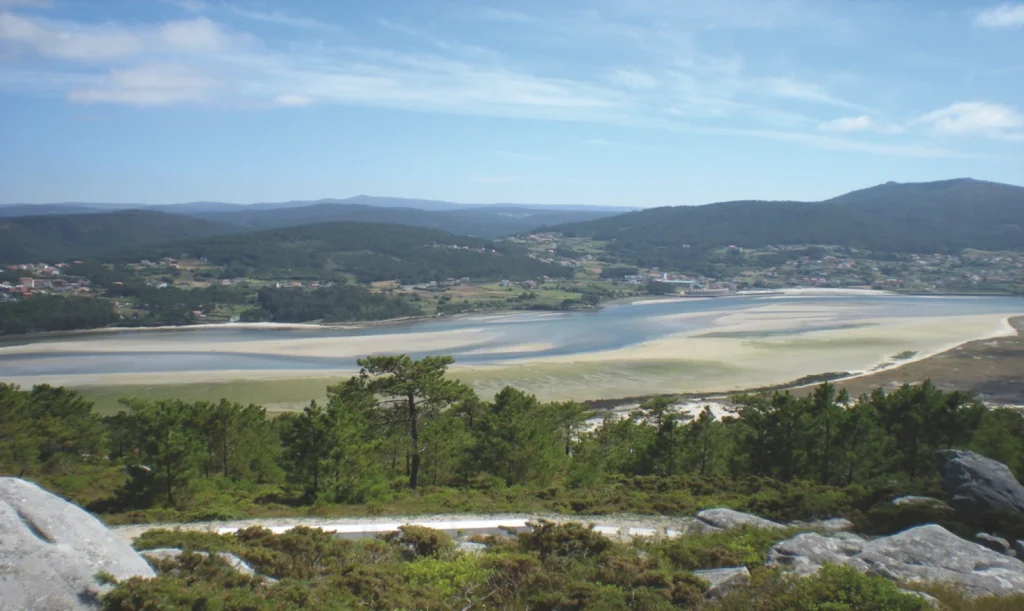
Head up the forest trail from the car park near the hillfort to Monte Gontón and keep walking from there to the viewing point at the top of A Fernandiña, the best place to enjoy the view over the mouth of the river Anllóns and the ría of Corme and Laxe.
Then walk to the hill of O Castro or Castelo de Borneiro, a named after the castro that was there, and then walk down to Borneiro, which has a parish church. Then set off to the sanctuary of O Briño and from there to the dolmen of Dombate. After visiting this spectacular megalithic monument, walk to the castro of A Cidá and you’re back at the starting point.